|
Menu:
|
Documented: 2006-11-26 | ||||
|
Once upon a time, there railway network in Roslagen was biggger than one could imagine. It stretched from Stockholm Ö to Rimbo to Faringe-Uppsala, Hallstavik-Gimo-Örbyhus, and Norrtälje. But from the late 1960's and onwards, traffic on these lines started to decrease and the final stretch of the "national rail" service betwee Lindholmen and Rimbo was shut down in the early 80's and the traffic was shortened to Kårsta. Today, the stretch between Kårsta and Rimbo is very well preserved, but without the railway of course. Some signs of the old railway still remain, but otherwise it's just a path, leading to Rimbo. This day I've walked with a friend of mine from Kårsta to Näs gård, about 1km away from Rö. But due to the short days of Sweden's November weather, it cut short and we had to end our walk at Näs gård instead of Rimbo. |
|||||
|
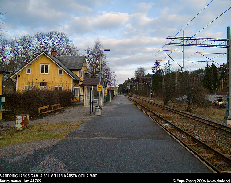
First a general picture of Kårsta station. |
|||||
Another picture of the whole Kårsta station. The railway to the right is taken away and the rail to the left is rarely used, probably just during the summer when they run museum transportations up to Kårsta. |
|||||
|
Km 42. This is the end - No trains may pass any longer than this for as long as the red sign is there... |
|||||
|
This is the definite end - NO trains may go any further than this. For me, I still want the railway to Rimbo! |
|||||
|
Same place, but taken from the other end. The irony in this is - How many driver's will actually see this sign when driving his/her train? Again, this is one of the proves that Rimbobanan might come back some day... |
|||||
|
No more railways now. Now it's just a plain path leading to Rimbo, eventually. |
|||||
|
I'm not really sure where this picture was taken, but probably somewhere right before the lake Sparren. |
|||||
 An old bridge which trains went across on once upon a time... |
|||||
|
Km 43. I'm surprised that these old signs are still around! |
|||||
 Signs of macadam! Maybe they never cleaned up this path so carefully... |
|||||
|
The afternoon sun shinning behind our backs...warming us up... |
|||||
|
Here we finally meet the lake Sparren, which will be parallel to us for a couple of kilometers. |
|||||
|
And we enter the woods again. |
|||||
|
Km 46. Now the ground is geting pretty mushy from the rain during the previous night. |
|||||
|
Km 46. The old rusty sign is still going strong! |
|||||
|
Believe it or not, but this is actually an old stop! the name of it shop be Sparren, right before km 48. This stop was here at least until 1912, but I couldn't find this stop on timetable for year 1925. |
|||||
|
Km 48! We are just a few hundred meters away from Sparren and we are in the open fields now again. |
|||||
|
Now we better be close to Näs gård since it's getting dark quicker and quicker and it would be impossible for us to walk when it becomes dark. |
|||||
|
Km 49. Just about 1km away from Rö then. Näs gård is right behind me right now, but I was not able to take a picture facing that way since the sun is on that side. |
|||||
|
And finally here! The bridge on the top is
the Lv280 which use to be the old E18 to Norrtälje. |
|||||
|
To be continued... |
|||||
|
|
|||||
| This page was created on 2006/11/27 and was last updated on Monday, November 27, 2006 20:43 | |||||